- Historical Context
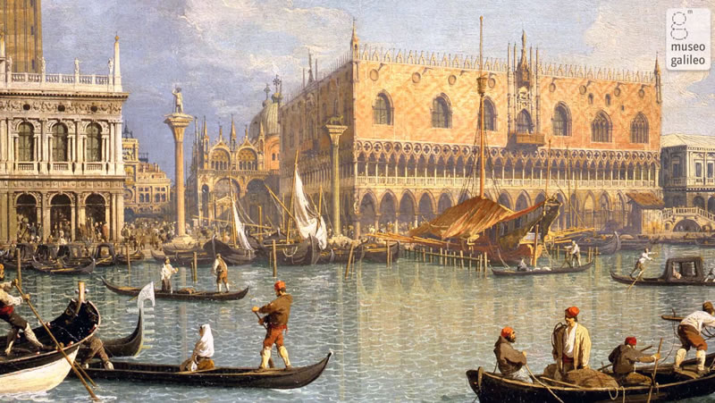
- Venice in the Era of Fra Mauro
- The Sea and Trade
- Fra Mauro
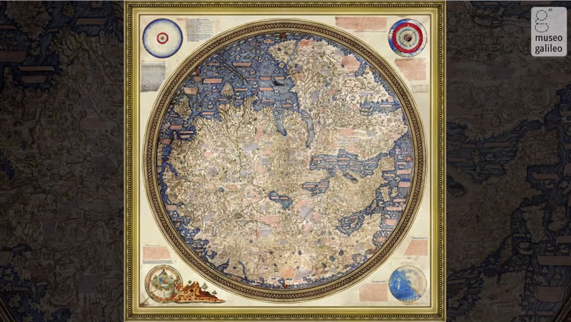
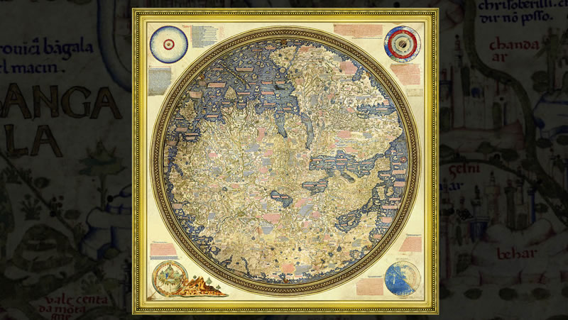
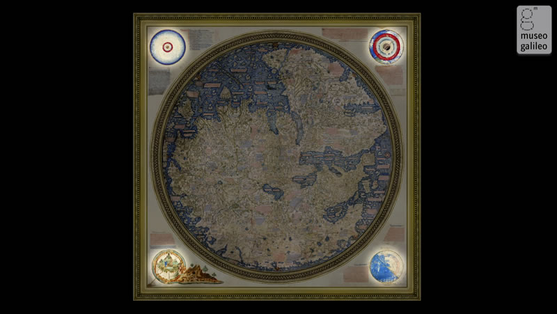
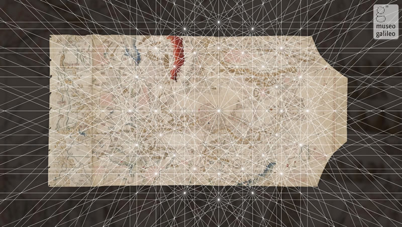
- The World Map
- Interactive Exploration
- Explore
- Cosmographic Space
- Geographic Space
- The Parts of the World
- The Places of Marco Polo
- Legendary Places
- The Lost Treatise on Cosmography
- Cosmography and sources
- Cosmographic Sources
- Missionaries and Ambassadors
- Merchants and Travelers
- Other Sources
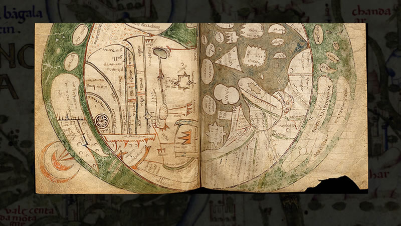
- Mappae Mundi
- 762-777 – Pseudo-Isidoro di Siviglia
- 1086 – Beatus de Liébana
- 1100-1125 – Beatus de Liébana
- 1210-1220 – Beatus de Liébana
- 1230 ca. – Mappa mundi di Ebstorf
- 1250-1280 - Mappa mundi di Vercelli
- 1300 ca. – Mappa mundi di Hereford
- 1375 ca. – Atlas catalan
- 1436 – Andrea Bianco
- 1442 – Giovanni Leardo
- 1448 – Giovanni Leardo
- 1448 – Andreas Walsperger
- 1450 ca. – Mappa mundi borgiana
- 1452 – Giovanni Leardo
- 1457 – Mappa mundi “genovese”
- 1460 ca. – Mappamondo catalano estense
- 1460 – [Benedetto Cotrugli]
- 1465-1500 – [Benedetto Cotrugli]
- 1470 ca. – [Benedetto Cotrugli]
- Designing the World
- Ptolemy’s Projections
- Ptolemy in Venice
- The Size of the World
- The World Map
- A Cartographic Model at its Limits
- Land and Sea
- Fra Mauro’s Marine Chart
- Marine Charts
- Navigation and Celestial Observation
- Measuring Time
- Astronomical Instruments for Navigation
- The Ships
- Dead reckoning
- Astronomical Navigation
- The Ship’s Position
- Latitude
- Longitude
- Magnetic declination
- Magnetic Compass
- The Wind Rose
- Techniques of Navigation